
Find great food stops on your way
Past the last big town, good food can be hard to find. Iconic Food Stops shows 36 great places to eat on your map. One is a pie shop on the Old Pacific Highway. One is the pink roadhouse at Oodnadatta. You can see which ones are on your way.
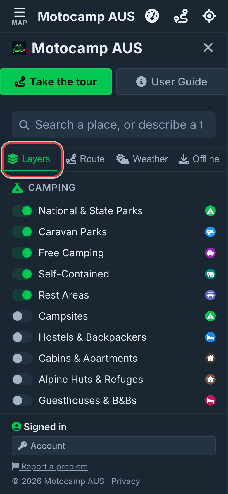
1Open Menu, then Layers
Tap Menu at the top left of the screen. Then tap Layers at the top of the menu. Layers is a list of things the map can show. Each line has its own switch to turn it on or off.
2Switch on Iconic Food Stops
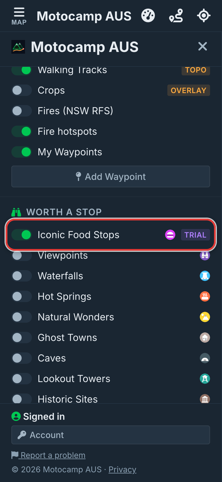
Scroll down to the heading Worth a Stop. The first switch under it says Iconic Food Stops. Tap it to turn it on. The app will remember this next time. Tap it again if you want the food stops gone.
3Close the menu and look
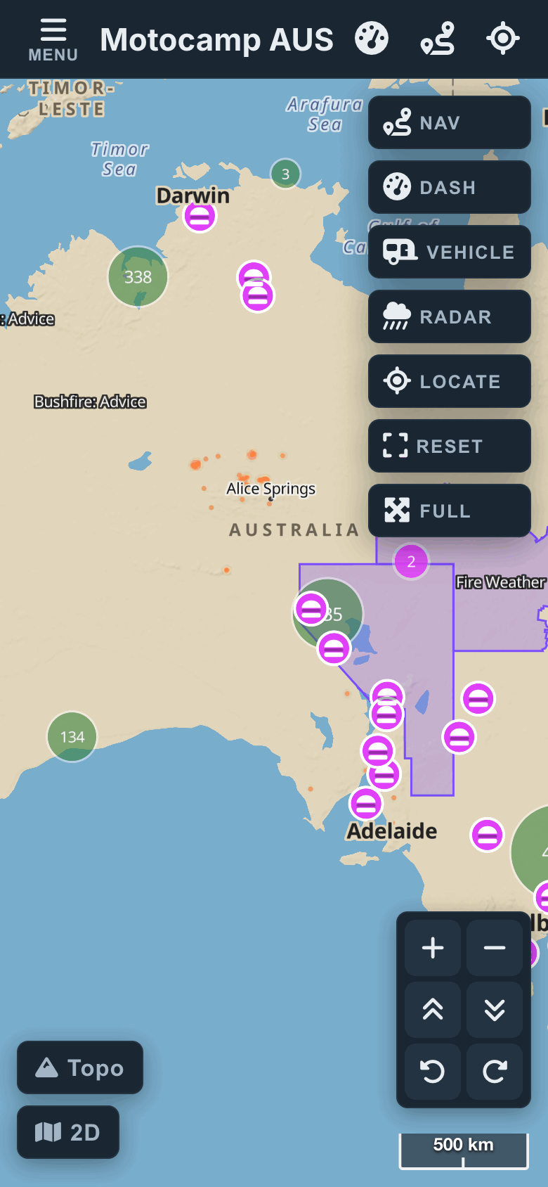
Tap Map at the top left to close the menu. Each food stop is a purple pin with a small burger on it. You can see all 36 at once, even when you zoom out. Zoom out to see the whole country. Then zoom in on where you are going.
4Tap a stop for its card
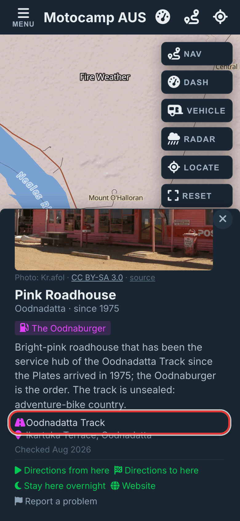
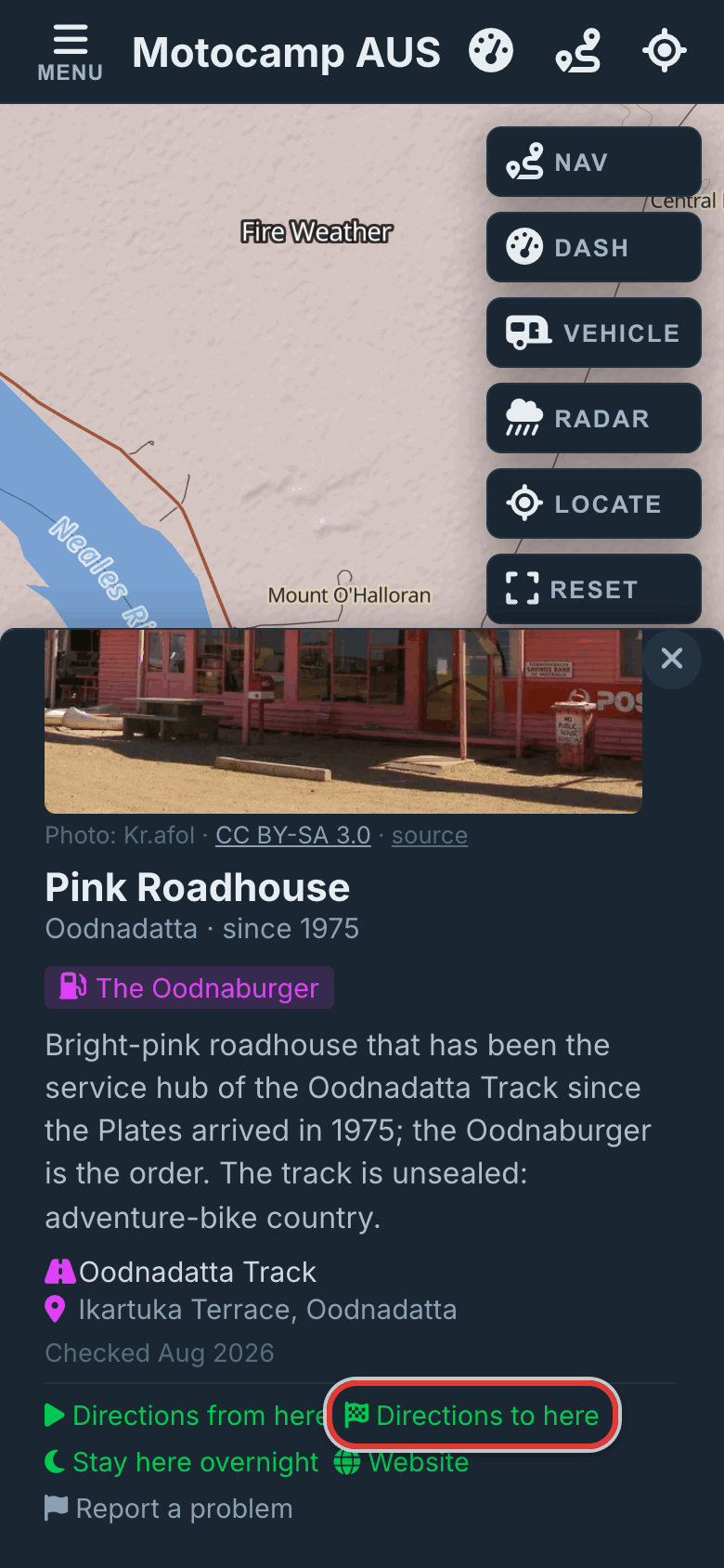
Tap a purple pin to open its card. You will see a photo if we have one. You will see the name, the town and how long it has been open. It says what people go there for, most often a dish. It shows the road it is on, so you know if it is on your way. The date at the bottom is when we last checked it.
5Get directions from the card
At the bottom of the card, tap Directions to here to plan a route to it. Tap Directions from here to start a route from it. If you already have a route, tap Head here next to add the stop. Website opens the place's own page. Report a problem lets you email us if something has changed.
Good to know
We picked all 36 places by hand, one at a time. They are not from a list of every cafe. Each one is a simple place that people know well. Each one is on a good road to drive. They are in every state and the Northern Territory, so some long roads have none. The card does not show opening hours. If a place shuts for part of the year, or on some days, the card says so. Read it before you drive a long way to one.
Also in the app: maps that work with no signal, campgrounds and free camps, and Plan with AI. It plans routes for eight kinds of vehicle, from an enduro bike to a 10-metre motorhome.